A while ago, whilst I was studying some maps on openstreetmaps from our vicinity, I accidentally came across the mention of a memorial stone commemorating the peace between Vikings and Franks at the Grönsfurth close to Fockbek in in 811/813. I was intrigued ; since we don't live that far from the spot, how can it be that we missed this for such a long time?
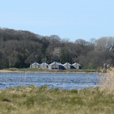
The stone itself is not particularly spectacular. If you happen to go for a walk between the river Eider and the sewage treatment plant, you might stumble upon it. Unfortunately, there aren't any further signs giving a little more context of the event. A superficial internet search also yielded but little results. The most information can be found on German Wikipedia (accessed on 17th July 2024) (translated via Google translate because I am lazy today):
"The two kingdoms of the Danes and Franks clashed at the Grönsfurth inland dune between Fockbek and Westerrönfeld. Peace negotiations between Vikings and Franks took place at the ford there in 811.
The location was favorable for the time: from Grönsfurth it is about 27 kilometers to Haithabu, a half-day ride for the Vikings on horseback. From Esesfeld Castle on the Stör, the knights on horseback only needed a day to reach the Eider ford. The negotiators of the Frankish king Charlemagne and the Viking king Hemming met there to negotiate the first German-Danish peace.
The fact that there was an important river crossing from north to south was mentioned in legends and traditions. The "border ford" was rediscovered in 2010. Only at this point did the sandy subsoil offer firm footing; along the rest of the length, a stretch of cliffs on the Lower Eider blocked smooth access to the water. "Högndor" means "the high gate", which in turn was the place name for the south side of the ford. Today, this refers to the flat hill on which the center of Westerrönfeld rises.
The field name "Grönhude" refers to a Hude, a wood storage or landing place or a small ferry point. The street name Grönsfurther Weg in Fockbek is identical to the former Ochsenweg, in a north-south direction the place where the oxen were driven across the Eider until a bridge was built near Rendsburg around 1200.
With the construction of the Eider Canal in the 18th century, the river was made navigable, and the ford was abandoned."
It may not be a place as vibrant as Hedeby, but nevertheless we are dealing with an area leading to numerous disputes which made diplomatic actions like this necessary.
Maybe you can find some places of great historical interest in your vicinity as well, which might not look the part on first sight but surly need some more attention? Depending on where you live they might be testimonies of "Vikings", or perhaps of one of their opponents, trading partners or (temporary) allies.